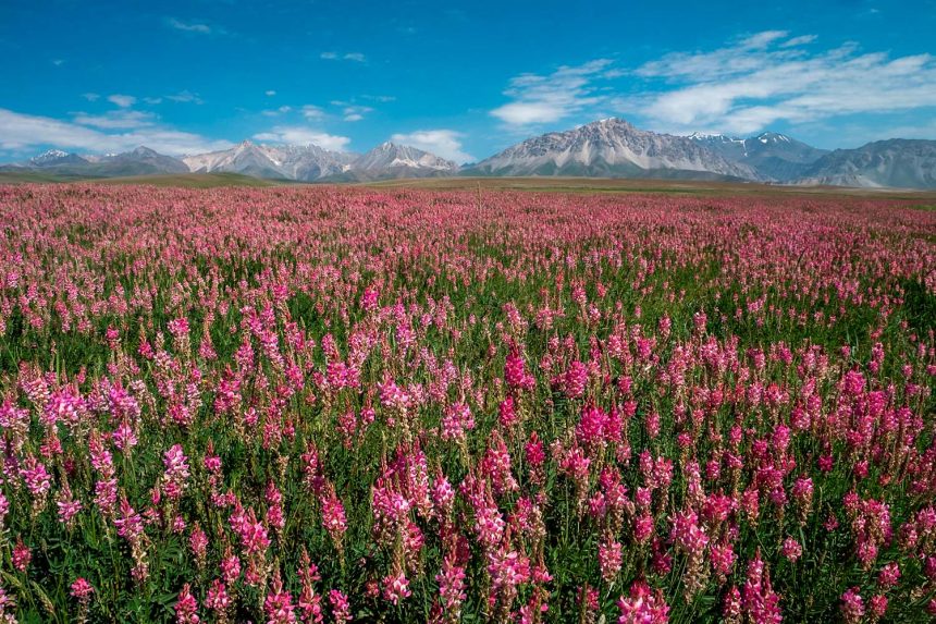
“Embark on an unforgettable Silk Road adventure through High Asia! Explore ancient trade routes, breathtaking landscapes, and vibrant cultures across Uzbekistan, Tajikistan, and Kyrgyzstan. A journey of history, adventure, and discovery awaits!”
Highlights from Silk Road Journey in High Asia Trip include:
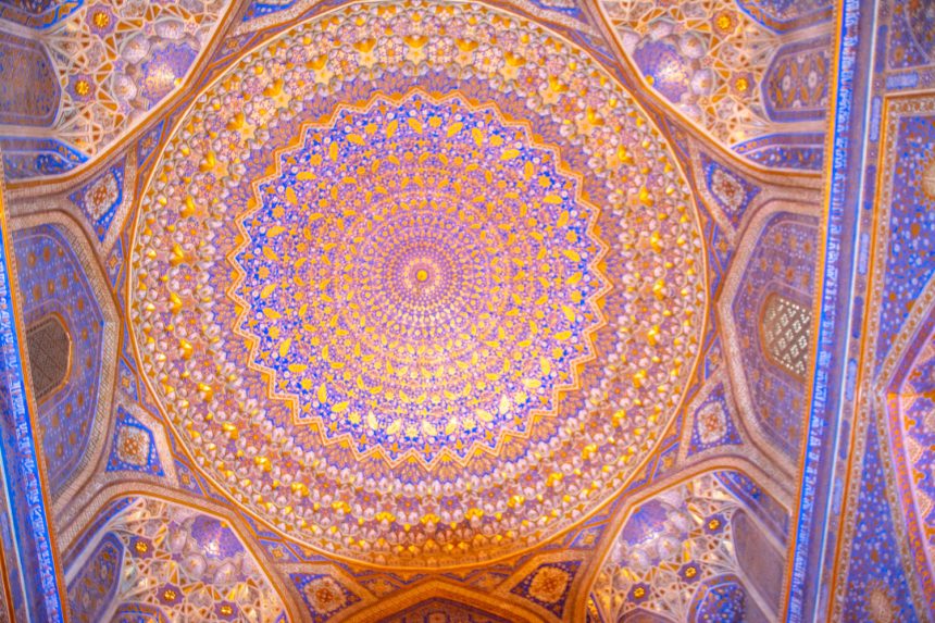
- Samarkand: Begin your adventure in Samarkand, home to majestic landmarks like Registan Square and vibrant bazaars. Its history as a hub of trade and culture sets the stage for your journey.
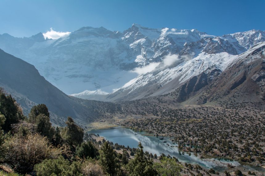
- The Majestic Fann Mountains – Trek to crystal-clear alpine lakes like Kuli-Kalon and Chukurak, surrounded by towering peaks and lush valleys. Explore the serene beauty of the Seven Lakes (Haftkul), each with its unique charm and color.
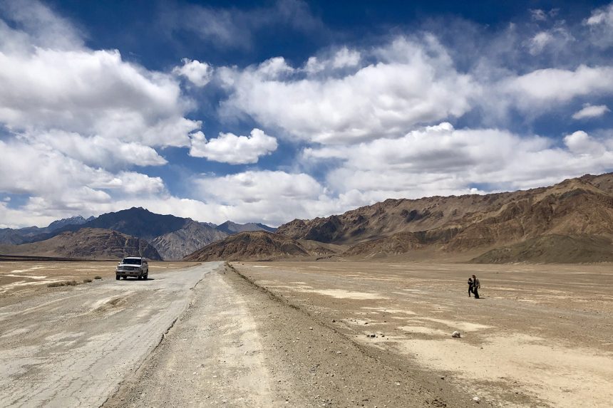
- The Legendary Pamir Highway – Drive along one of the world’s most dramatic high-altitude roads, offering unparalleled views.
- Wakhan Valley – Explore the enchanting Wakhan Valley, a remote and scenic region where the borders of Tajikistan, Afghanistan, Pakistan, and China converge. Marvel at snow-capped peaks, ancient fortresses, and immerse yourself in the rich cultural heritage of this historic Silk Road corridor.
- Lenin Peak Base Camp – Embark on a thrilling hike to the glaciers of Lenin Peak, a majestic 7,134-meter summit in the heart of the Pamir Mountains. Experience breathtaking alpine landscapes and the raw beauty of this iconic high-altitude destination.
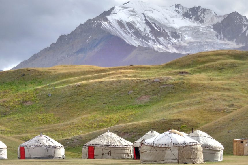
- 4-Day Heights of Alay Trek – Embark on an exhilarating trek through the breathtaking Alay Mountains. Traverse dramatic mountain passes, lush alpine meadows, and picturesque valleys, while soaking in panoramic views of towering peaks, including the majestic Lenin Peak. Immerse yourself in authentic Kyrgyz nomadic life by hiking through traditional nomadic settlements, staying in traditional yurts, and experiencing their unique hospitality. A perfect blend of adventure, culture, and natural beauty in Kyrgyzstan’s untouched wilderness.
- Osh City, Kyrgyzstan – Known as the ‘Southern Capital’ of Kyrgyzstan, Osh is one of the oldest cities in Central Asia with a history spanning over 3,000 years. Discover the iconic Sulayman-Too Sacred Mountain (UNESCO World Heritage Site), bustling bazaars, and rich cultural heritage. A vibrant gateway to the Pamir Mountains and the legendary Silk Road.”
Countries: Uzbekistan, Tajikistan, Kyrgyzstan
Start point: Samarkand, Uzbekistan
End point: Osh, Kyrgyzstan
Tour type: Cultural, auto, trekking
Duration: 15 days, 14 nights
Best Season: Mid-June to mid-November
Min / Max Elevation: 750m – 4800m
Overnight stays: Guesthouses, yurt camps
DAY 1: SAMARKAND TO SEVEN LAKES (HAFTKUL)
Start your journey from Samarkand as we cross the border into Tajikistan. Our first stops are the ancient city of Panjakent and the UNESCO-listed site of Sarazm, where you’ll glimpse Tajikistan’s Silk Road history. After lunch in Panjakent, continue the drive to the beautiful Seven Lakes (Haftkul). Each lake is known for its unique color and serene atmosphere. We’ll overnight by the seventh lake in a local guesthouse, surrounded by mountain views.
Driving distance/time: 125 km (78 miles) – 3-4 hours
Altitude: 2,300 meters (7,546 feet) at the seventh lake
Internet: Limited access in Panjakent; no coverage at the lakes
Electricity: Available in the guesthouse
Facilities: Shared bathrooms and basic amenities in the guesthouse
DAY 2: SEVEN LAKES TO FANN MOUNTAINS
Today, we drive back to Panjakent to visit the Rudaki Museum on the way to Artuch, dedicated to the Persian poet Rudaki, known as the father of Persian literature. After exploring the museum, we’ll continue toward Artuch Base Camp in the Fann Mountains. In the afternoon, take a scenic hike to Chukurak Lake, a pristine alpine lake surrounded by lush meadows and mountain peaks.
Driving distance/time: 130 km (81 miles) – 2.5-3.5 hours
Hiking distance/time: 4 km (2.5 miles) round-trip – 1.5-2 hours
Altitude: 2,200 meters (7,218 feet) at Artuch Base Camp; 2,450 meters (8,038 feet) at Chukurak Lake
Internet: No internet at Artuch Base Camp
Electricity: Available in the guesthouse (power bank recommended)
Facilities: Shared bathrooms and basic amenities in the guesthouse
DAY 3: HIKE TO KULI-KALON LAKE – EXPLORING THE FANN MOUNTAINS
Today, enjoy a rewarding day hike to Kuli-Kalon Lake, one of the most beautiful lakes in the Fann Mountains. The trail offers fantastic views of alpine landscapes and towering peaks, leading to the crystal-clear waters of Kuli-Kalon Lake. We’ll have a picnic lunch by the lake and return to Artuch Base Camp in the afternoon.
Hiking distance/time: 10-12 km (6-7.5 miles) round-trip – 4-5 hours
Altitude: 2,800 meters (9,186 feet) at Kuli-Kalon Lake
Internet: No internet at Artuch Base Camp
Electricity: Available in the guesthouse
Facilities: Shared bathrooms and basic amenities in the guesthouse
DAY 4: ARTUCH BASE CAMP TO DUSHANBE VIA ISKANDERKUL LAKE
Travel from Artuch Base Camp to Dushanbe with a scenic stop at Iskanderkul Lake. Known for its turquoise waters and surrounded by dramatic mountains, Iskanderkul is one of Tajikistan’s most picturesque alpine lakes. Short hikes around the lake take you to Snake Lake and the Iskanderkul Waterfall. After lunch by the lake, continue the drive to Dushanbe and arrive by evening.
Driving distance/time: 225 km (140 miles) – 6-8 hours
Altitude: 2,195 meters (7,201 feet) at Iskanderkul
Internet: Limited coverage at Iskanderkul; full coverage in Dushanbe
Electricity: Available at Dushanbe accommodations
Facilities: Standard hotel amenities in Dushanbe; Wi-Fi available
DAY 5: DUSHANBE TO KALAIKHUM
Welcome to the Pamir Highway!
Today we start our drive towards the gorgeous village of Khalaikhum. We will visit the 11th-century Hulbuk
Palace along the way before finally entering the iconic Pamir Mountains. After driving through the spectacular valleys of the Shurobod Pass we will arrive in the village of Khalaikhum. Here we will join the Panj River, which we will be following for the next few days, and have our first views into mysterious Afghanistan, just over the border. We will have dinner and overnight in a homestay.
Driving distance/hour: 352km / 219 mi – 6 hours
Altitude: 1200 m / 3,937 ft
Internet: Tcell (3G), Megafon (3G), Wi-Fi
Electricity: Available (bring a power bank just in case of outages)
Facilities: Shared indoor shower and western toilets at the homestays. Shared rooms for up to 4 people.
DAY 6: KALAIKHUM TO JIZEU VILLAGE
Today we drive towards the Bartang Valley and begin an adventure that may prove to be your favorite part of the trip. The 4x4s will drop us off at the trailhead to Jizeu Valley and we will commence a truly spectacular 2-hour hike to the remote Jizeu Village. The views we will discover on this hike are barren and wild, and this is known for being one of the real highlights of the Pamir Highway, that very few travelers visit. There are no roads to this village, so we will need to take our supplies with us for one night staying with local families. You do not need to bring much with you – just a change of clothes, medication, water for the hike, and your camera gear, and everything else will stay with our driver in the car. We will have lunch and dinner in the Jizeu Village.
This is an isolated region, and we will only be able to organize our accommodation once we arrive in the village. Food, blankets, pillows, and water are provided at the homestay.
Driving distance/hour: 205km/ 128 mi/ 5 hours
Hike: 6km/ 3.7 mi/ 2 hours
Altitude: Jizeu village 2,495m / 8,179 ft
Internet: No mobile coverage
Electricity: Available, Limited
Facilities: outdoor squat toilets at the homestays. Shared rooms for up to 6 people.
DAY 7: JIZEU VILLAGE TO KHOROG TOWN
We will wake up for sunrise in the remote Jizeu Valley before having breakfast. Once we collect our belongings, we say goodbye to our wonderful hosts and hike back towards the main road. Our driver will meet us there and we will continue our journey towards Khorog, one of the main towns along the Pamir Highway, with plenty of photo stops along the way. In Khorog you can stay in a comfortable homestay or hotel and explore the city afternoon, including a visit to the Khorog Botanical Garden, one of the highest in the world.
Driving distance/hour: 83km/ 52 mi/ 3 hours
Hike: 6km/ 3.7 mi/ 2 hours
Altitude: 2,200 m / 7,218 ft
Internet: Tcell (4G), Megafon (4G), Wi-Fi
Electricity: Available
Facilities: Shared indoor shower and western toilets at the homestays. Shared rooms for up to 4 people.
DAY 8: KHOROG. CITY TO LANGAR VILLAGE
While the traditional Pamir Highway traverses through the interior mountains of Tajikistan, we will choose to follow the Panj River and enter the famous Wakhan Corridor! We leave the town of Khorog and continue to gain altitude as we make our way towards Langar. Be amazed as the imposing Afghan mountains rise on our right-hand side and local farmers across the river go about their daily lives. We’ll stop off at the Ishkashim Fortress along the way then climb up towards the village of Yamchun. Here we will find the 12th-century Yamchun Fortress, with one of the most sensational views in the entire region. Next to the fortress is the Bibi Fatima Hot Springs, a natural bathing spot renowned for its healing properties. For those interested in a relaxing dip, the springs provide a rejuvenating experience, note that bathing is separated by gender, and clothing is not permitted inside the baths. After these highlights, we’ll drive back down towards the popular village of Langar.
Driving distance/hour: 110 km / 68 mi, 4–5 hours
Altitude: 2,900 m / 9,514 ft
Internet: Limited coverage (Tcell and Megafon)
Electricity: Available, but power outages are possible (carry a power bank)
Facilities: Shared indoor shower, outdoor western, and squat toilets at the homestays. Shared rooms for up to 4 people.
DAY 9: LANGAR TO ALICHUR VILLAGE VIA BULUNKUL LAKE
Today we leave Langar early and visit the ancient petroglyphs and fortress before passing over the Kargush nomadic Afghan farmers across the way and drive a short distance further to start the 4-hour hike up Panorama Ridge, which reaches 4800m above sea level and has insane views of the Wakhan Range of Afghanistan and remote lakes. It’s a moderate hike, but worth the views at the top. Once we descend, we’ll continue to the tiny village of Bulunkul and have the chance to see the high alpine lakes of Bulunkul and Yashikul. We will drive to the nearby Alichur village for our local homestay tonight.
Driving distance/hour: 240 km/ 149 mi/ 5 hours
Hike: 6km / 3.7 mi/ 4 hours reaching 4,800 m / 15,748 ft
Altitude: Alichur village -3,850 m / 12,631 ft
Internet: Limited mobile coverage (Tcell and Megafon)
Electricity: Solar Panels 12V, only for charging phones
Facilities: Shared outdoor shower, outdoor western, and squat toilets at the homestays. Shared rooms for up to 4 people.
DAY 10: ALICHUR TO KARAKUL LAKE
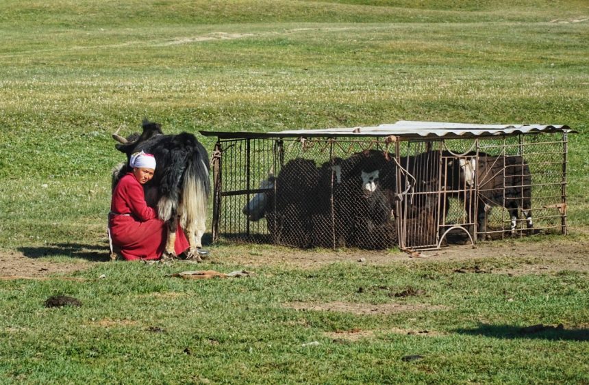
We’ll have breakfast cooked by the family and soon will head east along the Pamir Highway toward Bash-Gumboz village is located 30 kilometers from Alichur. Upon arrival, a local Kyrgyz family will welcome you to their track traditional yurt camp, giving you a glimpse of nomadic life in the Eastern Pamirs. Here, you’ll have the chance to enjoy a yak ride through the scenic pastures. Capture some incredible photos as you explore the landscape on yak-back—an optional experience that adds a unique memory to your journey. We shall have lunch in a local cafe in Murgab, then continue onwards to Karakul Lake. Today we cross over the 4655m high Akbaital Pass and then drive down to Karakul Lake at 4000 meters above sea level. Arrival at the lake with numerous households on the shore. Enjoy walking around this remotest village. The vistas, as you can appreciate, are phenomenal. Tonight’s accommodation will be in a local homestay near the shores of Karakul Lake.
Driving distance/hour: 352 km / 219 mi – 6 hours
Yak Riding: up to 1 hour
Altitude: 4,000 m / 13,123 ft (Karakul Lake)
Internet: No internet coverage after Murgab. Megafon 2G in Karakul.
Electricity: Solar Panels 12V, only for charging phones
Facilities: No shower, outdoor western, and squat toilets at the homestays. Shared rooms for up to 4 people.
DAY 11: KARAKUL LAKE TO TULPARKUL LAKE, KYRGYZSTAN
We begin the day with an early departure from Karakul Lake, heading toward the Kyrgyz border. After completing the formalities at the Tajik border post, we enter an 18-kilometer neutral zone, surrounded by stunning glaciated slopes, offering breathtaking mountain views. Once we cross the Kyrgyz border at Kyzyl Art Pass, the journey continues into the scenic Alay Valley.
Our first stop is the village of Sary Moghul, where you can have lunch. Afterward, a short one-hour drive brings us to Tulparkul Lake, situated at 3,500 meters (11,482 ft) above sea level. The lake is near the base of Lenin Peak, which towers at 7,134 meters (23,406 ft). At Tulparkul, you will stay in a traditional yurt camp, often regarded as one of the most beautiful in the region.
Driving distance/hour: 150 km / 94mi – 4 hours
Altitude: Tulparkul Lake -3,500 m / 11,482 ft
Internet: MegaCom
Electricity: Available only after dinner (bring a power bank just in case)
Facilities: Traditional yurts with outside shared showers and toilets
DAY 12: HIKE TO LENIN PEAK GLACIERS – SARY MOGUL VILLAGE
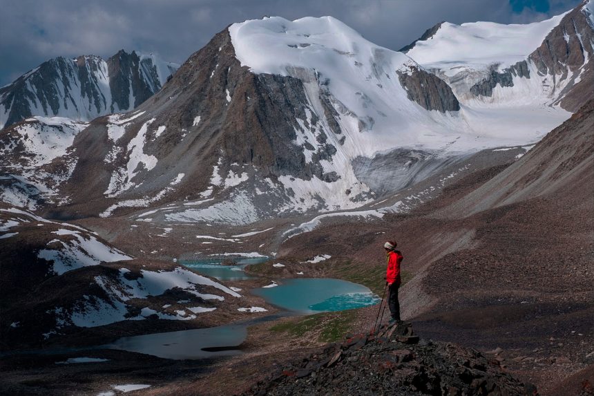
Begin the day with breakfast at the yurt camp, followed by a hike to Traveler’s Pass, located at 4,130 meters (13,550 ft). The 3-hour ascent starts just outside the yurt camp, crossing streams and winding alongside the Achyk-Tash River before reaching the pass. From this vantage point, you’ll be rewarded with breathtaking views of glaciers cascading from Lenin Peak, which towers at 7,134 meters (23,406 ft). After a break to take in the views, we’ll make the 2-hour descent back to the yurt camp. Following lunch, you drive to Sarymoghul village and get ready for the upcoming trek.
Driving distance/hour: 45 km/ 28 / 1 hour
Hike: 4-5 hours, reaching 4,130m / 13,550 ft
Altitude: Sarymoghul 2980 m / 9780ft
Internet: Available, Wi-Fi
Electricity: Available
DAY 13: TREK FROM SARY MOGUL VILLAGE OVER SARY MOGUL PASS (4,306M) TO CAMPSITE
Trekking distance/time: 15 km, 7 hours Ascent / Descent: 1059m, 859m
After breakfast, we will drive for 30 minutes from Sary Mogul village north to the starting point of the trek. We begin the trek by walking along for about an hour to the first viewpoint. Some parts are a bit challenging as the trail is narrow and the terrain is composed mainly of scree and small pebbles. We will take a break and enjoy the views of the Pamir Mountains from the viewpoint before descending into a valley for lunch. We will break for lunch by a riverbank with glacier views. After lunch, we will head to Sary Mogul Pass at 4,306 meters (1 hour). As you ascend, glaciated peaks and alpine lakes will begin to appear. At the top of the pass, we will see Besh Kol – this viewpoint has stunning views of the alpine lakes and nearby peaks. After descending we will walk down to the campsite at 3,557 meters. Enjoy your dinner under the stars at the yurt camp.
Accommodation: Shared yurt camp
Meals included: Breakfast, Lunch, Dinner
Facilities: No Wi-fi, no electricity, no hot shower, outdoor toilets
DAY 14: TREK TO KOSH MOINOK VALLEY VIA KYZYL SHORO VILLAGE
Trekking distance/time: 19,4 km, 7-8 hours Ascent / Descent: 866m, 1596m
Compared to the first day, the beginning of the second day is relatively easy-going and mainly downhill. As the trek progresses through the valley, the trail cuts back and forth across the river several times. With the decline in elevation, the terrain begins to change from high alpine rocky and dry to mid-mountain green punctuated by the alpine lush of juniper bushes. Don’t forget to turn around from time to time to enjoy views of the surrounding glaciers and snow-covered peaks above and behind you. Pass through fields filled with grazing cows and shepherd’s yurts inviting you for tea. Break for lunch near these yurts. After a few kilometers, you’ll reach the farmlands of the nearby village, Little Sary Mogul village. Pass through the village and walk for 3,5km along the dusty road to Kyzyl Shoro village. Break for lunch in Kyzyl-Shoro village at a homestay. Take a quick hot shower. After leaving your homestay, walk to the gorge to the east of the village. The trail slowly goes up, and ascends approximately 860 meters through grass meadows and pastures to Koshmoinok Pass at 3,210 m. After the pass, descend into Koshmoinok Valley (1 hour). Dinner and overnight in a yurt camp at 2,800 meters.
Accommodation: Shared yurt camp
Meals included: Breakfast, Lunch, Dinner
Facilities: No Wi-fi, no electricity, no hot shower, outdoor toilets
*Wi-fi, electricity, and hot showers are available during lunch in Kyzyl Shoro village
DAY 15: TO KOJOKELEN VILLAGE OVER SARY BELL PASSES THEN DEPART TO OSH
Trekking distance/time: 14 km, 5 hours Ascent / Descent: 464m, 1026m
After breakfast, cross over the stream and walk up to Sarybell Pass at 3,132 m (1 hour). Views of the rugged Kichik Alay Mountains open up on top of the pass. From there, follow the path as it winds along the edge of the hills. The red rock formations forming the “Three Dragon Gorge ” are one of the most beautiful spots in all of Kyrgyzstan. You can see the snow-covered Pamir landscapes in the distance with various grades of high, and low alpine landscapes along the way. The trail then descends through the red rocks and into a cliffed riverbed. You will follow the road through the cliffs until arrival in Kojokelen village (3 hours). Enjoy a home-cooked lunch. Depart to Osh city 3-4 hours driving. Get dropped off at your hotel. End of the trip.
| Number of Travelers | Price per Person (USD) |
| 1 traveler | 3800 |
| 2 travelers | 1950 |
| 3 travelers | 1400 |
| 4 travelers | 1100 |
What’s Included:
– Transportation: 4×4 Vehicle with fuel
– Driver Services: English-speaking driver, including his meals and accommodation.
– Additional Trips: Side trips
– Fees: Border fees
– Hiking Experience: 4-day hike in the Pamir Alay Mountains, which covers:
– Accommodation during the hike
– Meals during the hike
– Trekking guide services
What’s Not Included:
– Traveler’s Own Expenses: Meals and accommodation
– Entrance Fees: Entrance tickets to any attractions or sites.
– Permits/Visas: GBAO permit and visa fees.
– Horse and horsemen on 4-day trek


