The following is a personal travelogue and Parmir Highway guide from Doug and Margaret Johnson who traveled on our private Pamir Highway Tour from Osh, Kyrgyzstan to Dushanbe, Tajikistan.
Introduction: Travel Guide To Pamir Highway
For many years, Doug & Margaret, had read about and seen pictures of the Pamir Highway and the surrounding high altitude wonders. We wished for the experience.
Riding a bicycle seemed too much physical activity and hardship. Driving a rented car on Pamir Highway seemed to have too many uncertainties. Going with shared taxi seemed too uncomfortable. Touring in a private car for 8 hours a day seemed like we would miss the opportunity to really experience the mountains. What we really wanted was the chance to hike. We looked at multi-day treks and found that they only touch a tiny portion of the Pamirs.
Then we discovered Visit Alay and the opportunity for an itinerary with a hike almost every day. So in 2018 we booked an 11 day Pamir Highway tour Osh to Dushanbe with a private driver. The itinerary included 8 wonderful day-hikes. We left all the logistics to Visit Alay and our driver, and concentrated on enjoying our hikes, the landscape, and the people. Then we extended two more days all the way to the Uzbek border at Obyek, west of Khujand.
Getting to Osh required an itinerary of 5 flights all of which landed on time. Upon arrival we met Mohammad who would be our tour driver for the next two weeks. Sadly our luggage didn’t make it. Very helpful people with Turkish Airways and TezJet made special arrangements and 6 hours later Mohammed took us back to the Osh airport and we had our luggage. Otherwise, this arrival day was a rest day.
Our Itinerary from Osh to Dushanbe on Pamir Highway
Day 1: Osh to Sary Mogol
Early the next morning Mohammad picked us up in our 4wd. He took us to the best place to change money into Kyrgyzstan and Tajikistan notes. He took us to a supermarket to buy bottled water and trail snacks. Then we started our tour.
At the start of the itinerary, the road was good except for the occasional horses, cows, or hay trucks. There were plenty of farms, the land looked good, and the people looked prosperous. The further we get from the city the more yurts we saw.
We stopped for pictures and to stretch our legs at the first pass. Later we climbed to Taldyk Pass which at 3615m altitude is much higher. Looking back from Taldyk Pass we saw the winding road that everyone photographs. Looking forward one can see Lenin Peak way off in the distance.
We stopped in Sary Tash for lunch and were quite surprised by how good the food tasted. From lunch it was an easy drive to the town of Sary Mogol where we checked in to our first homestay in early afternoon.
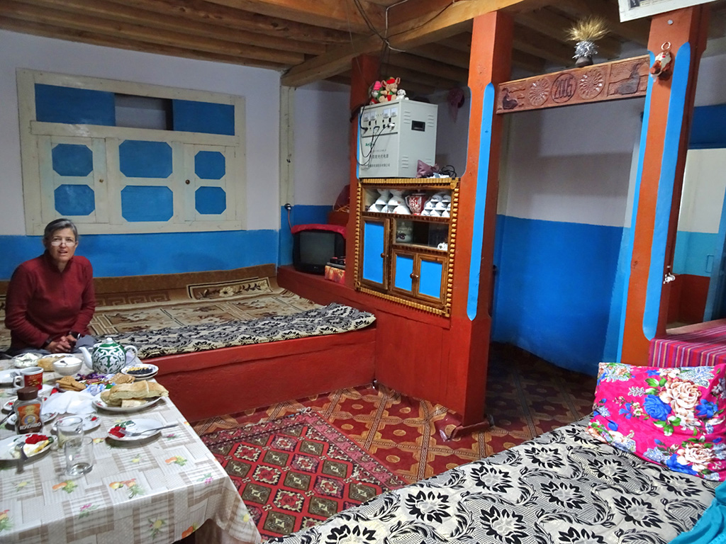
We knew from the itinerary that we would be staying in homestays, but we didn’t know what to expect. We got a nicely decorated private room with mattresses on the floor and a single bulb for light. The bathroom was in an outbuilding about 30m away. It had a western toilet with running water. The adjacent building had a sponge bath setup using water that was heated on a wood burning stove.
We were served dinner [marginal] and breakfast [great]. The cost was $15 US per person. The homestay would also take local or euro if we chose. All afternoon and evening other groups kept arriving. Pretty soon the rooms in this house were filled with late arriving guests. Many were sent to other houses.
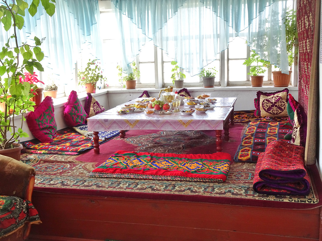
Lunch at homestay in Sarymogol village
We spent the first afternoon walking about 5Km all around Sary Mogol. It was much more comfortable to be in this small town than the noise and hustle of Osh. We visited the market. We played with kids, we watched craftsman build a new house. We took pictures.
Day 2: Beshkol Lakes & drive to Lenin Peak Base Camp
The drive to the trailhead took about an hour on a rough back country road. We were glad to have a 4wd. We followed a grassy valley with a nice stream running down the middle. All the way we passed families in yurts with goat herds. Then the road ended and it was time to walk.
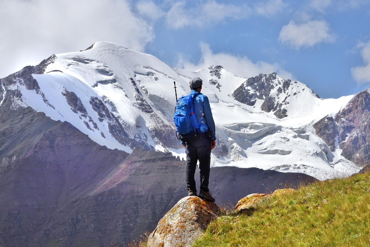
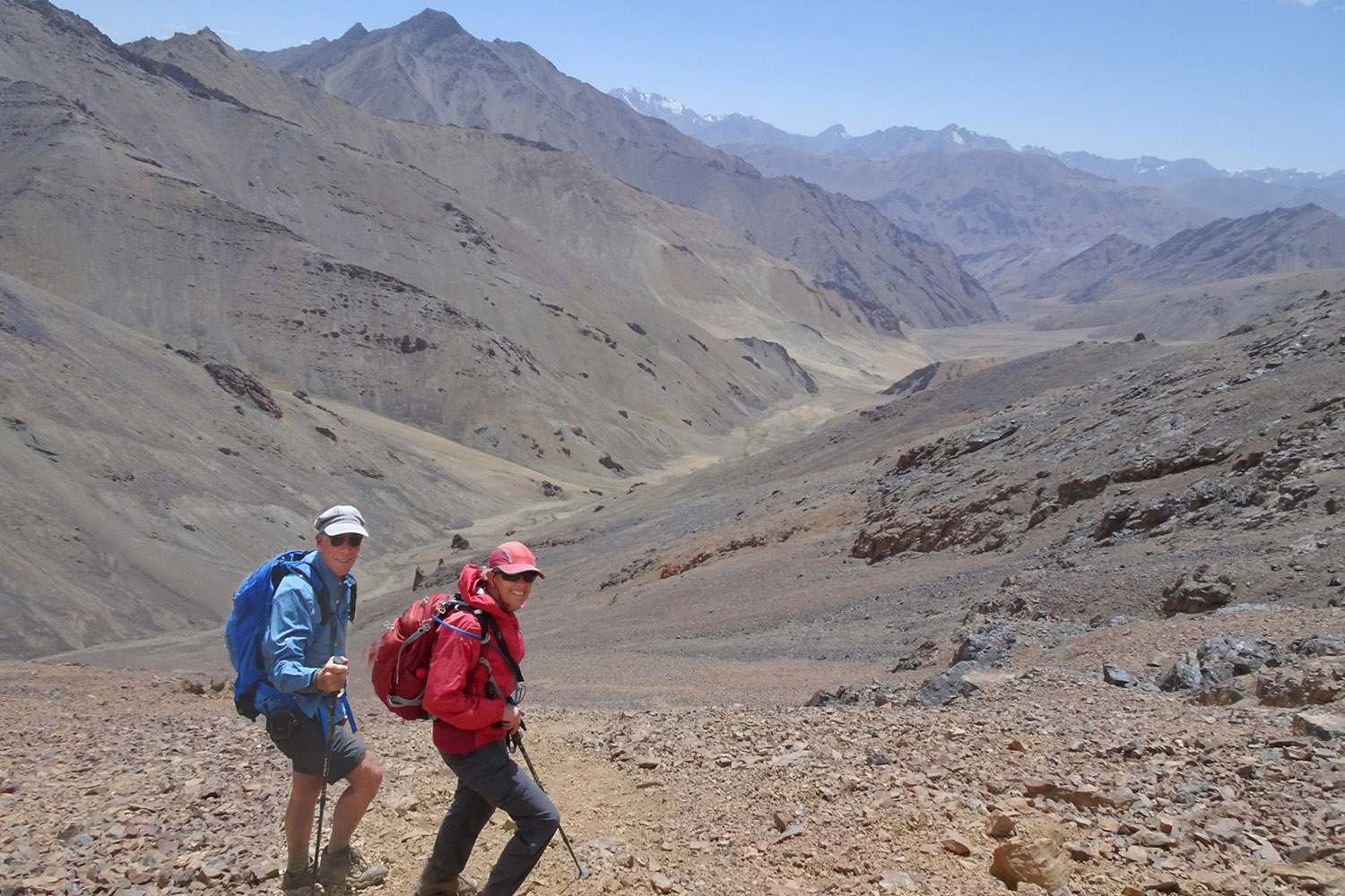
It rained the last night and the skies were still cloudy so the views were not a wondrous as high altitude Pamirs can be. We had a guide [for $30] even though there was a good trail to follow. Visit Alay wanted to be sure we were safe hikers. Pretty soon we climbed up to a high altitude plateau. Then it was into the riverbed until high water from the rains forced us to take a detour.
When we reached 4200m altitude we were in a big valley with glaciers and peaks all around us. There were yaks grazing and a couple of males yaks were fighting. There now were patches of blue sky and some interesting opportunities for photographs. We visited the lakes at 4300m but did not stay long because it looked like it could rain again. This hike was about 17Km in length, 980 meters up, and took 6 hours.
Alpine Lake Besh Kol near Sarymogol Pass
Mohammed drove us back to Sary Mogol town and then another hour to the yurt camps at Tulparkol Lake near Lenin base camp. There are two different yurt camps CBT and Lenin Peak. We stayed at Lenin Pik which with 7 yurts is the smaller of the two. There are no showers so cleaning up required a trip to the lake.
Dinner was the same meal as we had for the whole tour: vegetable soup, potatoes, pasta, and a garnish of grizzly meat. It was a cold afternoon under mostly cloudy skies so we dressed in all our layers. The yurts, however, were warm due to airtight stoves which camp staff tended during the evening.
Day 3: Lenin Peak views and drive to Karakul Lake
Breakfast is normally at 8am, but the staff agreed to serve us at 7am so we could get an early start to see Lenin Peak. By 7:30 we were on the trail.
When we reached the first viewpoint about 10 minutes from camp we saw clouds covering all the peaks. We decided to keep going and pretty soon arrived at Base Camp where there are multiple accommodations that can hold hundreds of visitors. As mentioned in numerous blogs, no-one stopped us.
Just above base camp is a large plateau a few km by few km that slopes gently upward. As we walked along this plateau we got one glimpse of a corner of Lenin Peak. Then it was gone again. We decided to skip the kike up to Travelers pass because we would have no views of Lenin Peak until the very top of the pass and if the clouds cleared again for only a few minutes we would miss the view. Instead, we walked to the edge of the plateau and waited, and waited, and waited.
Finally, we could wait no longer because Mohammed had told us we needed to leave at noon to drive to Karakul. Morale was low as we walked back downhill. Then, when we were just below the Base Camp, Lenin Peak suddenly cleared. The show lasted about 15 minutes until the clouds returned. The views might not have been as spectacular as we might have seen from Travelers Pass [had we been lucky enough to have been there at exactly the right time]. We like our pictures anyway. Our day of hiking was 14Km in length with 420m of elevation gain and loss.
After lunch we hopped into the 4wd and started towards Tajikistan. The road deteriorated and got worse and worse until it was just a rough dirt road.
Exiting Kyrgyzstan was simple although it took 30 minutes of socializing. After we cleared, we chatted with a border guard and wound up giving him a pen with American flags that he fancied. The rough road continued to the top of Kyzyl-Art Pass at 4282m altitude. The Pamirs were a beautiful red color. It was so windy that we managed just two minutes out of the car.
We saw two groups walking their bicycles and quietly agreed that we made the right choice by choosing a 4wd over a bicycle. A few km down from the pass we come to the Tajikistan border checkpoint. This checkpoint was much less efficient and took over 70 minutes. Our tour driver even had to pay a $50 bribe.
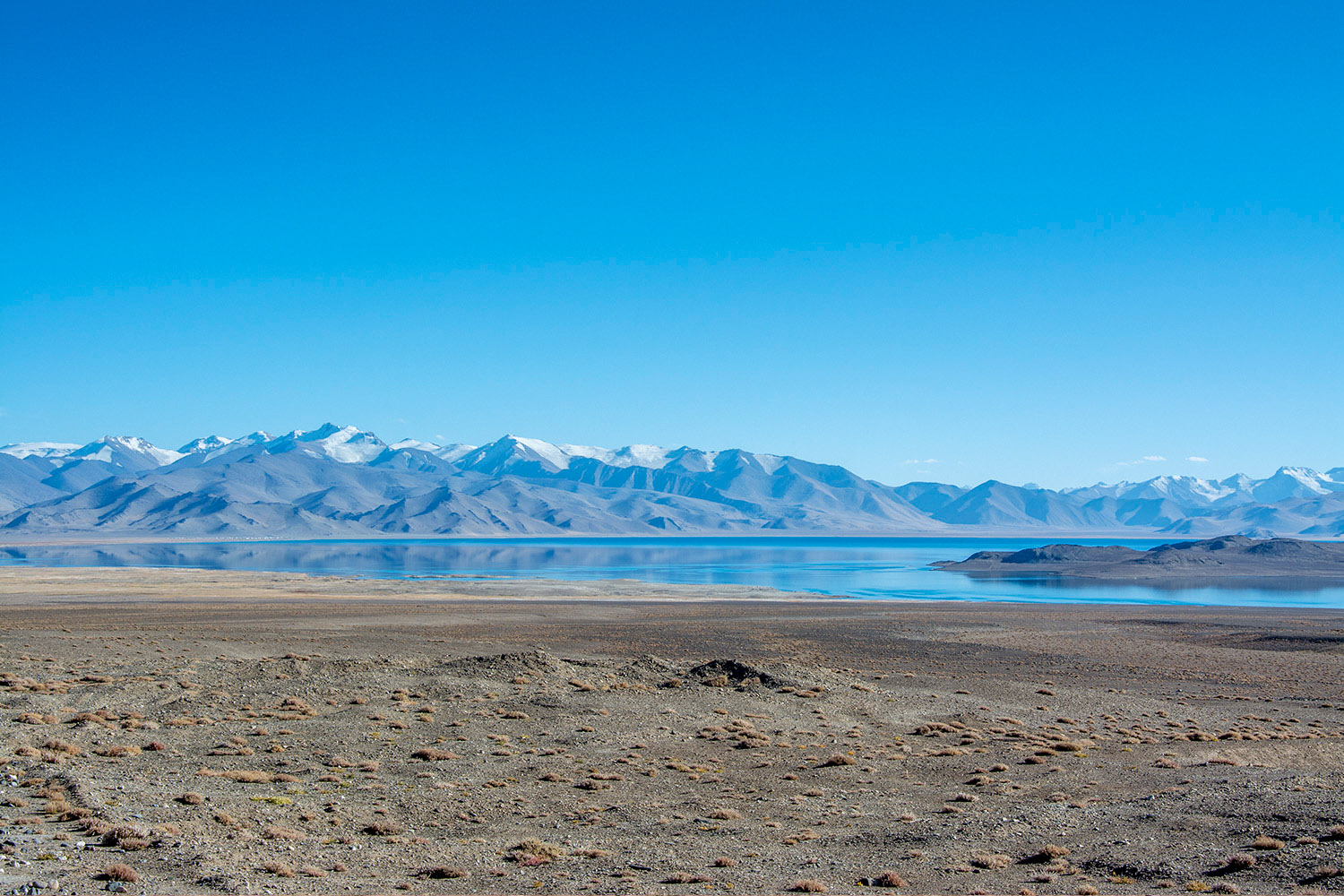
It was a short ride from the Tajikistan border to Karakul. The landscape dried out and there was little grass, few bushes, and no trees. The sun shone brightly under clear dry Pamir skies. For maybe 100Km there was a new border fence erected by China on the left side of the highway.
In Karakul, our homestay was named Sadat. Contrary to what has been written elsewhere they have nice bathrooms, a good sponge bath room, and electricity. Once again, we get a private room. Our cell phones actually worked, however the 2G internet was really slow due to other users.
We did as most visitors do and walked to Karakul lake. We didn’t stay long because the wind was strong. Walking through town and getting a feel for Pamir living conditions was more interesting. Back at the homestay, the 8PM dinner was soup, pasta, and tea/coffee. Cost was $30 for 2 persons.
Day 4: Hike up Ortoboz Pass at 5041 meters & drive to Murghab
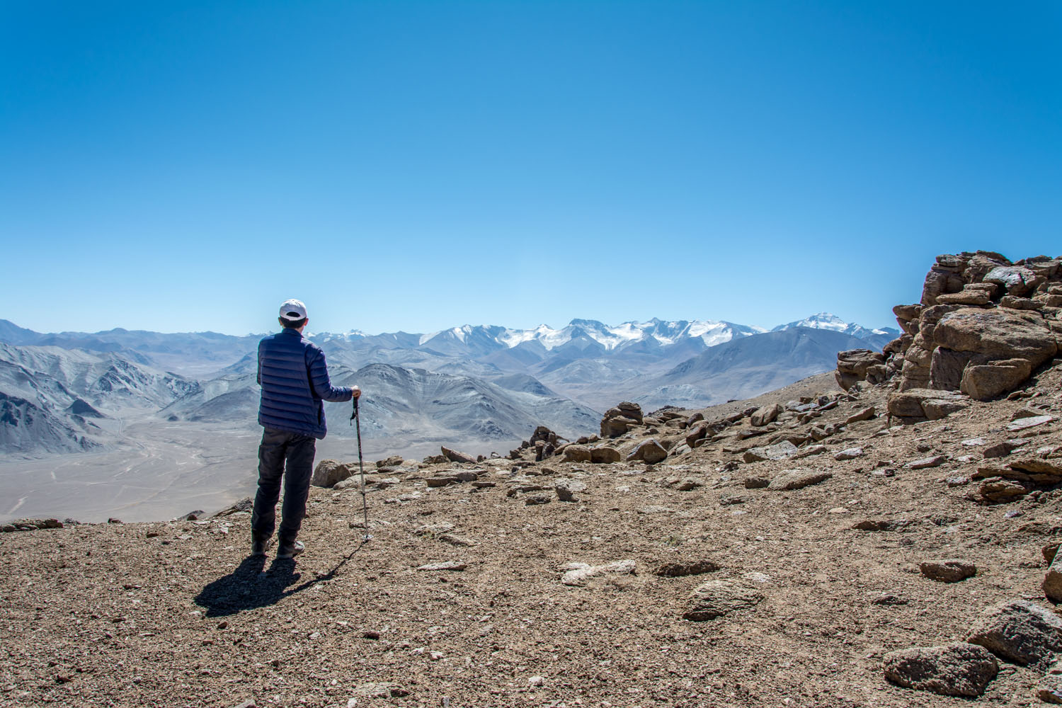
Today we hike up a Ortoboz Pass near Karakul Lake to get a view of the lake and the Lenin Peak Pamirs. Mohammed drove to about 4150m altitude at which point the road became too rough for our 4wd. The itinerary said we had 5070m destination. The ski was cloudless and the weather was surprisingly warm. There was no trail, just an easy to see destination.
The day was so nice that Mohammed decided he wanted to hike too. However, he was slower and we calculated we will not make the summit if we all stayed together. So we went ahead ourselves. The first half of the hike was in grassy meadows. The second half was on rocky ground.
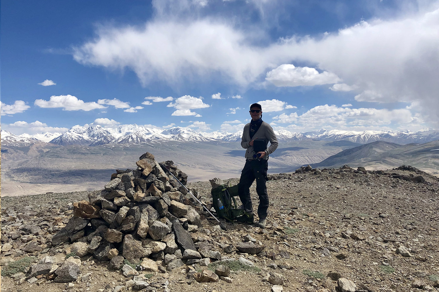
In the grassy area, we found two sets of ram’s horns, which Tajik law says must not be removed. So we took only photos. In the rocky area, we saw plenty of fresh hoof prints, but we never saw an actual animal. We celebrated at 5000m. The air was still and the temperature was pleasant. After the summit we descended to the 4wd and Mohammed who arrived about 10 minutes before us.
We covered 11km length and 900m of altitude in 4.5 hours.
Except for a pass, the road from Karakul to Murghab was relatively good. The scenery steadily improves as the Pamirs become colorful again. We cross 4655m Ak Baital Pass which was rough gravel with potholes.
By 4pm we were in Murghab at the Pamir Hotel where a room had been reserved for us. However, there was no one to check us in. Mohammed called and worked the check-in problem and finally a hotel clerk showed up. We really appreciated having an experienced guide who was saving us from anxious moments and potential mistakes. By this time we had also gotten to know Mohammed, his character, and his trustworthiness. We have come to feel completely save and at ease in his company. We learn that Mohammed is from Murghab and will later go visit his parents. So we were on our own for dinner. Mohammed patiently explained what to expect.
The Pamir hotel has a real shower and plenty of clean water. So we cleaned ourselves and washed 4 days’ worth of clothes. In their dining room they serve a great chicken dinner plus cold beer. The 2G internet worked well enough that we could receive and send an email. The cost for the room and breakfast was $30 for 2 persons. Dinner cost the two of us $9.50 total. There is a very large open-air market in Murghab and we made plans for the next day to stock with things we would need along the Pamir Highway.
Day 5: Pshart to Madyan Valley hike & drive to Alichur
At 9AM we headed to the bazar for more bottled water, a local SIM card, and do paperwork. The SIM card turned out to be useless. We had heard that the carrier with whom we roam – Beeline – had little coverage in the GBAO and that Megafon was a better choice. Sure enough there was better coverage with Megafon, but everyone knew there was better coverage and where there was signal the Megafon 2G internet was useless. Turns out that Beeline – where it worked — actually had better internet because everyone else had Megafon. The only advantage was that it was easier to call Mohammed since he too had Megafon.
At the bazar, Mohammed made copies of our passports and visas for each checkpoint. We were first in line at the copy center and were done in 10 minutes. Others had to wait and wait. Once again having a local guide was paying dividends.
To get to the start of our hike [Pshart], we left Murghab and headed a few km back toward Karakul, then turned and drove west 10+km on a dirt road. The trail began at a yurt camp where some tourists were getting a demonstration of Tajik customs.
We said goodbye to Mohammed and hiked up the long valley. The weather was beautiful and we enjoyed watching grazing yaks, the green grass along a gentle stream, and the colorful Pamir scenery. Our GPS map said there was a road, but we saw no sign of it.
After 90 minutes, the grasses gave out and we found ourselves walking on loose stones called talus. Here we accidentally strayed from the best trail and after some difficulty reached the pass 30 minutes later than planned. We spent just 10 minutes at the 4733m altitude pass, sheltered behind some rocks, out of the wind. The Pamir scenery was were fantastic. The trail down was obvious and we descended 500m of altitude in what seemed like minutes. At the bottom was a stream where we soaked the dirt off our feet. 4 to 5 km from the end we passed a yurt and were invited in for cheese and tea. Unfortunately we did not have the time to stop else we would have been late for our rendezvous with Mohammed. We hiked 16Km in length, 750m up and 1200m down.
The drive out the Mayden Valley was along a verdant green river with colorful Pamir mountain backdrop. We stopped to give a fellow hiker from Belgium a ride. He was about an hour ahead of us on the trail and when he got to the end, his driver was missing. [We finally met his driver who was two hours late]. We were happy to help and even happier to have a reliable driver provided by Visit Alay.
The drive to Alichur on the Pamir Highway was along a decaying paved road that got progressively rougher and rougher. We were very happy to arrive at the homestay that Mohammed usually used only to find out that they had booked another large group and we would have cramped shared quarters.
The owner pointed out another homestay about 500m away and Mohammed drove us there. After 5 minutes of negotiation with the owners of this substitute homestay, Mohammed told us we would stay here for the night. We had a fine room in a nice house called Umar. There was a good clean bathroom and the usual hot-water-on-the-stove sponge bath. Grandmother and daughter took good care of us while the kids peaked around the corner at their new guests.
We were the only ones in the house that night and the owners had questions for us which Mohammed translated. It was by far our most memorable homestay. And as usual, dinner, breakfast, and the room was $30 for 2 persons.
Day 6: Panorama Peak hike and drive to Langar
Once again we awoke to a cold clear day and a tasty breakfast. After a half hour of driving the Pamir Highway pavement ended. We would not see pavement again for 4 days.
We took an hour long side trip to Bulunkul Lakes. These lakes were probably the least inspiring of anything we saw in the Pamirs. Then it was on to Panorama Mountain. This name is not on the maps, it must be a nickname from Visit Alay and/or other hikers. It is on the downhill side of Kargush Pass and at first looks like an uninteresting walk up a bland colored mountain. But once at the top there were the most incredible views of snow-covered Pamir Mountains in Afghanistan.
By now we were in good physical shape and well acclimated to the altitude so it was about an hour up, and an hour down. We spent another hour at the top taking pictures and watching a martin [a kind of a weasel]. All total we hiked 5.5Km in length and 550m of altitude change.
From Kargush pass we descended to the Wakan Valley along the Pamir River. At times we were just 2m from the river’s edge. Afghanistan is on the far shore.
At one narrow spot we threw rocks across the river and can, therefore, claim we were within a “stone’s throw from Afghanistan”. At other times we were high above the river and had splendid vistas of rugged Afgan Pamir mountains. In this area, the Pamir Highway was rough – gravel with potholes – but the views were so inspiring we didn’t mind. We saw several groups cycling and none looked like they were enjoying themselves. We were very glad to have the comfort and safety of our 4wd.
The Pamir Highway descent into Langar was like coming into a green oasis. Here the Pamir and Wakhijil rivers come together to form the Panj. It is obvious that the standard of living along the river is higher than the standard of living in the high plateau towns of Karakul, Murghab, and Alichur. We drove to the first homestay that Mohammed had reserved only to discover it was full already.
We were now beginning to see a trend that with increased tourism along the Pamir Highway the original homestays – the driver’s usual stops — are filling up. Once again it is a blessing to have Mohammed to safely find us alternatives. Our next stop was a nice new homestay. Everything was fine except for the shower which used river water full of glacial silt. We’re not sure whether we were cleaner before or after the shower.
At the Langar homestay we met a group of 4 students who, in a tiny car, were driving the Pamir Highway to Murghab the next morning. Now we had taken two days to go from Murghab to Langar and appreciated that we had the chance for activity other than sitting in the 4wd the whole way. We didn’t think those four students were going to enjoy the trip nearly as much as we did.
Day 7: Engels Peak hike and drive to Yamchun
It was a windy night and by morning the valleys were filled with airborne dust. So we were happy that it was only a short Pamir Highway drive from Langar to Zong and then a steep climb up above the dust and through picturesque farms to the trailhead for Pik Engles.
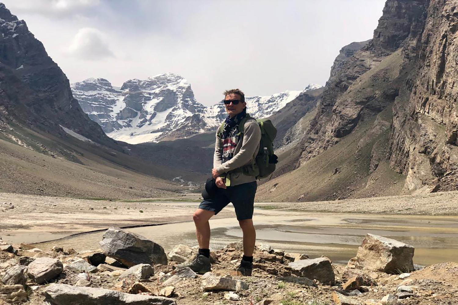
Our hike started poorly thanks to some bad directions from a 7-year-old. But with GPS and a trail marked on the map we were on the proper route soon enough. For over 6km the route follows a canal. The grade is gentle and the grass is green from abundant water. The views of the Wakhan valley , snow covered Afgan Pamir mountains, and villages along the Panj River were exceptional. Once the trail left the canal, the grade got steeper for the next 3 km. Then all of the sudden Pik Engels comes into view.
In a lush green meadow, we walked right past the Engels basecamp. and hiked on to the trail’s end at the upper lake. After a stop for lunch and a quick soak in a chilly stream, we returned by the same route. Our total hiking length was 22Km with 750m of altitude gain/loss.
After that wonderful hike we returned to the Pamir Highway and its bumps and dust. In this part of the tour, the key attractions were the Afgan villages [much lower standard of living than Tajikistan] and the Afgan roadway paralleling the Panj river. We repeatedly saw the Tajikistan military walking along the highway and were glad that they were keeping us safe.
Mohammed told us our next stop would be the Yamchun Fortress a few Km from the Bibi Fatima Hot Springs and a roughly 10km from the main Pamir Highway. When we got to the fortress, the light was bad so we decided to visit in the morning. We drove on to the hot springs and checked into the accommodations there.
This was by far the worst place we stayed – our room, the dining room, the bathroom, all were terrible. We think this was the first time Mohammed had been there because he first went to a different much nicer place only to be told his reservation was elsewhere. We had passed several nice homestays near the fort and would advise readers to stay there. We also skipped the hot springs because from the outside they did not look very appealing and because there are separate times for men and women. This was the only place on our whole trip where we did not feel very safe.
Day 8: No hike, drive to Khorog
The morning trip to the Yamchun Fortress was inspirational. Since we were there early, we were the only ones and could explore in silence conjuring memories of past millennia.
We spent the rest of the day driving the Pamir Highway along the Panj feeling safe in Tajikistan [compared to Afghanistan]. We passed numerous bridges between the two countries; they were all closed. We passed more cyclists who were all struggling with the road.
We stopped at Khahkha Fortress to stretch our legs and see the ruins. Most everyone goes to the high ground, but we found much better ruins down low and to the east. As we were leaving the fort by the footpath we passed two local women with their children. A boy about 10 asked us if we like president Trump. We had a nice talk with them about vacations and about the USA, then wished each other well and traveled on. All in all they made a nice memory.
The closer we got to Khorog, the more the road improved and the more we could see signs of modern civilization. Visit Alay had told us that we could book a regular hotel in Khorog, so we used an internet booking service and selected a place.
It turned out to be a homestay with just three rooms. It was exceptionally clean and had city water, 24×7 electricity, good internet, and even a modern kitchen. We did laundry and Mohammed washed the 4wd. We were given the owner’s bedroom and they slept outside. This homestay did not offer dinner so Mohammed took us to a nice restaurant in Khorog where we treated him to dinner which came to $15 for all three of us including a round of drinks.
Day 9: Hike to Jiseu Valley
After a wonderful breakfast, we set out for Jisev. Around noon, we started across the bridge over the Bartang River. Our destination was a series of villages between 5km and 9Km up the trail. All we knew is that we cannot get lost because the trail follows the river, that there is a homestay around 7Km that speaks English and at 9km there is a homestay called Zaro recommended by Visit Alay. The hike was pretty and gained altitude quickly.
After 7Km we had hiked past a few homes which appear in somewhat primitive condition but have seen no English. We stopped to rest under a nice tree. A few minutes later we were startled by a 20-ish girl coming around the bend in the trail. She asked in good English where we are going and if she can help us.
We admitted we were looking for a homestay to which she responds, “I have a homestay, would you like to follow me?” We decided why not and followed her 2km to the Zaro Homestay. Murina was a delightful host. She was energetic, 24, trained as a nurse, and spoke excellent English. Not only did we have a homestay, but we had a tour and a thoughtful discussion about life in the Jisev valley. Dinner and breakfast were the best of any homestay with lots of fresh ingredients right out of the garden and dairy. Jisev should be on everyone’s itinerary.
The whole upper Jisev valley is magical. Gorgeous lakes, tall Pamir Mountains, fresh water, and all the walnuts, apricots, apples, and cherries one can eat.
Day 10: Hike out from Jisev and drive to Kalaikhum
The next mooring we were very sad to leave, but we knew Mohammed would be waiting for us at 11 am because it was a long drive to Kalaikhum. The stretch of the Pamir Highway to Kalaikhum is half tarmac and half gravel. There were hundreds of Chinese trucks headed east and Mohammed drove carefully and safely. It would have been dangerous to be on a bicycle.
Homestay in Jiseu Valley
There Pamir Highway between Khorog and Kalaikhum was less scenic and less adventuresome than the eastern part. It was just a long drive and we were happy when we reached Kalaikhum.
Even though Kalaikhum has only 2000 residents there is a modern upscale business-class hotel. We made reservations a week in advance by email. They first quoted us $200 a night but said if we were part of a tour we could have a double room for $90 a night. For $90 it was worth it. However, we learned there was no equivalent upscale restaurant and it took Mohammed to find us even a very modest place to eat.
Day 11: Drive to Dushanbe
The distance from Kalaikhum to Dushanbe is over 350Km. Because the roads soon get much better the ride was pleasant. Midway, you leave the canyon of the Panj river. From that point on, the scenery is very different. And the magical feeling of exploring a remote region where one needs to be always vigilant was gone. We had returned to civilization.
It was Sunday and there were many wedding cars on the road. They were all nice luxury white cars decorated with red ribbons. We followed one into the parking lot of a viewpoint and the group got out and started to party.
Dushanbe stuck us as a very nice clean city. The first excitement was finding the hotel we had booked. Our GPS map said one place. Mohammed’s GPS map said somewhere else. Neither was correct.
Mohammed cleverly hailed a taxi and we followed the driver to our hotel. The second excitement was Mohammed telling us that he was staying cross town and we were on our own for dinner. We managed just fine mostly because while studying the pictures on a menu an English school teacher offered to help.
Our final Dushanbe experience was going to a variety store and purchasing a toy truck for Mohammed to give to his son who would be turning 4 years old the next day.
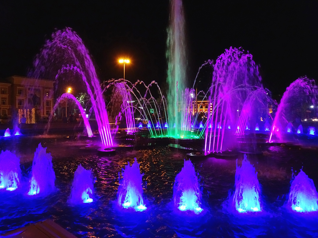
Fountains in Dushanbe
Extra — Day 12 & 13
Most tours end in Dushanbe where it is easy to catch planes back to Europe and Asia. We chose instead to spend a week in Uzbekistan and because there were no planes or trains between Dushanbe and Tashkent we had no choice but to go by car.
We previously arranged with Visit Alay to extend our itinerary and have Mohammed take us from Dushanbe to the Obyek border with an overnight stop in Khujand. The road was excellent and the drive was scenic but not as scenic as the Pamir Highway. Still, it took 7 hours to get to Khujand due to many slow trucks on the high passes. Along the way we stopped to buy apples and we stopped at the Mug Tepe Fort in Istaravshan.
When we got to Khujand, we tried to go to the highly regarded fort museum, but it was closed on Mondays. So just spent our time walking around town, visiting a lovely park, and eating a kabob dinner under a tree where hundreds of birds came to roost. Our room for the night was in a Soviet-era apartment converted to Airbnb type accommodations. Overall it was a fine day.
Crossing Tajik-Uzbek border at Oybek check-point
Tuesday morning, it was only an hour’s drive from Khujand to the Obyek border. Mohammed drove as far as he could, and then we had to get out and walk. Leaving Tajikistan we stood in an unruly line with 30 men pushing their way forward. People kept wedging in front of us and we were getting no-where. Then all the sudden an immigration officer spotted us and, telling everyone to get out of the way, took us to the front of the line where our passports were stamped no questions asked. “Special service for tourists” he told us.
Next, we walked 500m to the Uzbekistan side. Here again was a crush of people trying to squeeze through one door. This time we joined in the pushing and used our big suitcases to block others who might wedge in front of us. Most Tajik citizens were processed in 2-3 minutes.
It took us well over 15 minutes and three agents to get a passport stamp. We think it is because we had the new online visa and this may have been the first ones they’d ever seen. (Very few foreigners come across this border an officer had told us). After immigration there is customs. There was no line because immigration is the choke point. We put our bags on the X-Ray conveyor. And we were fully expecting a thorough search as described on so many Pamir websites. Instead, the lady didn’t even look at her monitor; instead, she wanted to know all about Aurora, Colorado where she has relatives. And that was it, we walked straightaway into Uzbekistan.
Summary
Much is written about the Pamir Highway. Doing our research, we got the impression the Pamir Highway was going to be a cold, difficult, and dangerous place. We worried that we might have signed up for a more adventure than we could comfortably tolerate. The reality was totally different. We felt totally comfortable and safe. The level of adventure was moderate, not extreme. Despite the remoteness, we felt very relaxed on every hike.
Below is our experience on some specific issues:
Pamir Highway Altitude Sickness
We had no problem with the altitude. Then again, we have a house at 2700m and spent a few afternoons at 4300m before flying to the Pamirs. For others, however, it helps you a lot if you spend two days in Kyrgyzstan before heading on to Tajikistan.
The Sary Mogol village is a good option to stay the first night since it is at 2900 meters. The next spot for a second night is the yurt camp at Tulparkol Lake at 3600 meters. (From this yurt camp you do the most spectacular hike up to Lenin Peak glaciers.) We have read and heard of many people doing high altitude trips who take a medicine called Diamox Tablet. To use it, you should consult with your doctor first. Here is a useful article about high altitude acclimation.
Digestive Problems from Food:
One time we ate something that did not agree with us. We had brought antibiotics with us and our problem was gone in less than 24 hours. Everyone traveling to areas of the world with different hygiene should be traveling with antibiotics.
Temperatures on Pamir Highway
Our trip was in the second half of August and the temperatures were very pleasant, even when above 4000m. We mostly wore long sleeve shirts. When we hiked, we brought a second shirt and a windbreaker. We had down vests for cold evenings, but they were only used once. Visit Alay informed us the best months to travel and do hikes is from mid-June to late-September. Even still, there is a possibility of a cold spell or even light snow at any time of the year since it is highland country.
Money:
Visit Alay gave us a recommendation of how much local money to bring. We followed the recommendation and it was perfect. We paid for homestays with USD – crisp new $10 and $20 notes. We paid for the hotel in Kalaikhum, Dushanbe, and Khujand by credit card.
We paid for our meals with local currency. Price of dinner + B&B is about 15-20 USD per day/person at homestays on Pamir Highway. Lunch is maximum 5 USD per person at cafes en route. We saw ATM’s in Khorog, Dushanbe, and Khujand should they be needed. H
owever, bringing local cash helps you and your host a lot since the local ATMs in Tajikistan are not reliable. The host might not have small notes to give a change back. You can use VISA or Master Card in Osh city. The good bank for both cards is Demir International Bank in Osh city. How much you need all depends on the length of you stay and what you do on your trip.
Money Exchanging:
You can either exchange your cash either in Osh city or Murgab village. In Osh, you can only change at special exchange boxes at the Kelechek Bazaar. Our Visit Alay guide helped us. In Murgab village, the exchange takes place in the local bazaar. Most recommendations say you get a better exchange rate in Osh city, but it is difficult if not impossible to change back to dollars or euros. So it may be worth being cautious and changing multiple times. Exchange rate differs, so check it the National bank of Tajikistan.
Visa to Tajikistan:
It is a good initiative that Tajikistan simplified the visa process. You can get an online visa (we did) by visiting the E-Visa Tajikistan website. While applying, do not forget to tick GBAO permit. Without it, you are not allowed to enter The Pamir Highway.
Car Breakdowns:
Sure enough, we passed quite a few vehicles on the Pamir Highway having difficulty. Thankfully, we never had any difficulty with our 4wd. Most breakdowns were in villages and we simply drove past. In a rural area, we stopped once to help out with tools that Mohammed carried.
Hitch Hikers on Pamir Highway:
People looking for rides were everywhere. We had asked Visit Alay whether we would have to stop for hitchhikers and were told that we were not expected to stop. Sure enough Mohammed just drove on by. Of the several dozen tourists we met, only one couple asked us at breakfast if they could hitch a ride. Thankfully we were headed the other direction. Read more about sharing transport with other travelers at here.
Rules of Road:
It was very helpful to have a professional driver like Mohammed. He understood the various customs and best practices. Little things like local time being one hour off of official time, not driving at night in certain places, appropriate stopping at Pamir Highway checkpoints and pushback against bribes meant the tour went completely according to the itinerary.
Border Crossing:
Our border crossings were painless and without incident. I’m sure Mohammed helped. It also helped that we had all our paperwork in order. We followed all the rules about medications and other prohibited items and were never even checked.
Pamir Highway Safety:
It is so sad that four cyclists were killed while riding in Tajikistan On July 29, 2018. After the incident, the government took special precautions for safety. We saw road police at all spots and taking special care of tourists. In less than a month, the government of Tajikistan had constructed a very nice monument in memory of these cyclists.
It is our opinion that other blogs and websites have unfairly biased the potential Pamir Highway traveler into thinking this would be a cold, dangerous, and difficult journey. Our experience was positive.
Example: The Uzbek border crossing had no inspection and was easy, except for pushing and shoving
Example: We didn’t get approached by anyone seeking bribes or engaging in threatening behavior
Example: We were never overcharged by a homestay.
Most other guests we talked to on our summer 2018 Pamir Highway trip had also read these various blogs and websites and openly cautioned everyone about various risks. I can honestly say I have felt less secure and more threatened when traveling to places such as New York City, Los Angles, Chicago, Delhi, Rio, etc., than I felt along the Pamir Highway.
By Doug Johnson
December 1, 2018